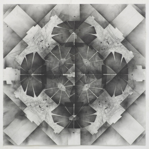
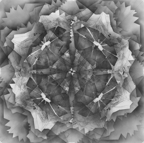
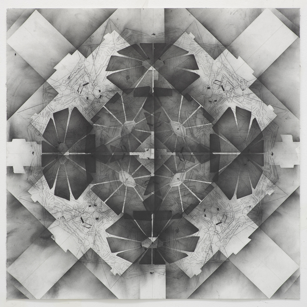
Ideal City/Fortress City
While driving through the Mojave desert, about six miles past Palmdale there is an earth drawing etched into the flat desert floor. It brings to mind the Nazca Lines in Peru, the crop circles in rural England, or the design of Hindu mandalas. It also speaks to the recent history of land art in the American Southwest and would fit nicely within the monumental earthworks of 1970’s land artists. But this formation is a massive military satellite calibration marker. It serves a purely utilitarian function. This series of powdered graphite drawings use 16th century urban fortress schematics and other designs related to the intersection of habitation and defense to create a unitary blend of the military, the meditative, and the sacred.